

If you only download one cycling app this year, make it match the job you actually need done. Strava wins for tracking rides and staying motivated through community challenges. Komoot or Ride With GPS lead for navigation and route planning, especially on unfamiliar roads. TrainingPeaks and TrainerRoad dominate structured, power-based training, while Zwift remains the top pick for immersive indoor riding. Most of these apps offer generous free tiers, but offline maps, turn-by-turn voice guidance, and adaptive training plans usually sit behind a paywall. A full comparison table and app-by-app breakdown follow below.
TL;DR:
- Using the right app depends on your main goal; for navigation, Komoot offers offline maps and turn-by-turn guidance, especially on unfamiliar roads.
- Athletes focused on structured training should consider TrainerRoad or TrainingPeaks for evidence-based, power-driven plans, rather than relying solely on immersive indoor platforms.
- While Strava dominates social tracking with segments and leaderboards, it lacks offline navigation and full mapping features, which are behind paywalls or better handled by specialized apps.
- For long rides, pairing a dedicated head unit with a phone app for social sharing and route backup is more efficient than relying solely on a phone’s GPS, which drains battery quickly.
- Combining two or three apps tailored to specific jobs—such as route planning, activity logging, and social motivation—delivers the best overall cycling experience, rather than choosing a single all-in-one platform.
Picking from the best cycling apps on the market gets easier once you stop comparing them head-to-head and start sorting them by the job you need done. A rider training for a century ride has completely different needs than someone navigating unfamiliar switchbacks above Lake Como for the first time, and the app that wins for one job often falls flat for the other.
The table below groups the major contenders by their primary strength, so you can jump straight to the apps worth your download.
| App | Best For | Platforms | Free / Paid | Offline Maps / Nav | Sensor Integrations | Standout Feature |
|---|---|---|---|---|---|---|
| Strava | Social tracking and motivation | iOS, Android, Web | Free tier; paid subscription for segments/analysis | No | ANT+, Bluetooth, Garmin, Wahoo | Segments and leaderboards |
| MapMyRide | Simple ride recording | iOS, Android, Web | Free with paid MVP upgrade | Limited | Bluetooth | Easy for casual riders |
| Komoot | Route discovery and turn-by-turn nav | iOS, Android, Web | Free first region; paid region packs | Yes | Garmin, Wahoo | Sport-specific routing |
| TrainingPeaks | Coach-led structured training | iOS, Android, Web | Free basic; paid premium | No | ANT+, Bluetooth, Garmin | Coach workflow and analytics |
| Ride With GPS | Detailed route planning | iOS, Android, Web | Free tier; paid Plus/Premium | Yes (paid) | Garmin, Wahoo | Route authoring and export |
| MyWindsock | Wind and weather planning | iOS, Android, Web | Free with premium forecasts | No | None | Microclimate wind mapping |
| Flare | Safety and incident alerts | iOS, Android | Free with premium features | No | Bluetooth | Live location sharing |
| Zwift | Immersive indoor group riding | iOS, Android, Windows, macOS, Apple TV | Subscription only | Not applicable | ANT+, Bluetooth, smart trainers | Virtual worlds and events |
| ROUVY | Realistic indoor route simulation | iOS, Android, Windows | Free trial; subscription | Not applicable | ANT+, Bluetooth, smart trainers | Real video routes with gradient |
| TrainerRoad | Power-based structured training | iOS, Android, Windows, macOS | Subscription only | Not applicable | ANT+, Bluetooth, smart trainers | Evidence-based training plans |
| Wahoo SYSTM | Combined cycling and strength training | iOS, Android, Windows, macOS | Subscription only | Not applicable | ANT+, Bluetooth, Wahoo trainers | Integrated strength workouts |
| MyWhoosh | Free indoor group rides | iOS, Android, Windows | Free | Not applicable | ANT+, Bluetooth | Free immersive events |
| Golden Cheetah | Deep performance analytics | Windows, macOS, Linux | Free, open source | Not applicable | ANT+, Bluetooth | Advanced analytics with no fee |
| Garmin Connect | Garmin device ecosystem | iOS, Android, Web | Free | Yes | Garmin devices | Deep device integration |
A few quick call-outs before you scroll further:
One thing catches new users off guard almost every time: the free version of a mapping app rarely includes offline maps or full voice navigation. Komoot’s free tier covers a single region, and expanding coverage means buying region packs or a World Pack. Budget for that before a big trip, not during it.
Strava remains the reference point for tracking rides and staying accountable to a cycling community. Its segment system lets you race against your own past efforts or the entire local rider base on a given climb or descent, and the kudos and comments culture works as a surprisingly effective nudge to get back on the saddle. BikeRadar’s testing consistently ranks it as the top choice for daily tracking and social sharing, largely because the routing behind its heatmaps reflects where real cyclists actually ride, not just where a generic algorithm thinks they should. The free tier covers ride recording, basic stats, and segment participation; the paid subscription unlocks detailed fitness analysis, live segment leaderboards, and route-building tools. It syncs with ANT+ and Bluetooth sensors, plus Garmin and Wahoo head units, so your power and heart rate data flows through without manual entry.

MapMyRide takes a simpler approach and that simplicity is the entire point. If Strava feels like a social network with a fitness tracker attached, MapMyRide feels like a fitness tracker that happens to let you share results. It’s a solid pick for someone who wants clean ride logs without the leaderboard pressure, and its route-recording accuracy holds up fine for casual and commuter riding. The catch: its offline and integration features lag behind the specialists, so serious tourers and racers tend to outgrow it quickly.
Garmin Connect deserves a mention here too, not as a social platform but as the companion app that makes a Garmin head unit worth owning. It handles ride sync, historical data, and training load tracking, and its integration with Garmin devices is deeper than any third-party app can match. If you’re already invested in Garmin hardware, Connect is the backbone that ties everything together, even if you also run Strava for the social layer.
Phone-based tracking apps are convenient but merciless on battery life, especially with the screen on for navigation. A five-hour ride with GPS logging, screen brightness up, and a data connection active can drain a fully charged phone before you’re back at the hotel. BikeRadar’s guidance on this is blunt: carry a power bank or use a mount with a charging cable if you’re recording anything longer than a couple of hours.
The more elegant fix, and the one most experienced tourers land on, pairs a dedicated head unit for recording with a phone app for social sync and mapping. Record the ride on a Garmin or Wahoo unit, then upload to Strava or Ride With GPS once you’re back on Wi-Fi. Your battery lasts, your data stays accurate, and you’re not squinting at a cracked phone screen while riding one-handed along the lakefront.
Pro Tip: If you’re touring for several days, record on a head unit and let your phone stay in your pocket. You’ll get better battery life, cleaner tracking data, and you’ll actually notice the scenery instead of watching a map.
These tracking apps do a great job logging where you’ve been, but they’re not a substitute for local knowledge on complex or unfamiliar routes, something worth remembering if you’re riding along Lake Como’s mixed traffic zones for the first time.
Route planning apps solve a different problem than trackers do: instead of logging what you did, they decide where you should go, and that decision reflects a philosophy baked into each app’s routing engine.
Komoot builds routes around surface type, elevation profile, and cycling-specific road preferences rather than treating a bike route like a slightly slower car route. It offers full offline maps and turn-by-turn voice navigation, and it syncs cleanly with Garmin and Wahoo devices for riders who prefer a dedicated bike computer on the handlebars. The free version covers one region completely; expanding beyond that means buying additional region packs or the World Pack.

Ride With GPS shines when you’re planning something more ambitious than a single loop, a multi-day bikepacking route, a club ride with cue sheets, or a route you want to share with a group. Its point-of-interest layer and elevation profiles are unusually detailed, and its export tools play well with most Garmin and Wahoo units. Offline maps sit behind the paid Plus or Premium tiers.
Beeline takes a distinctly different approach with its compass mode, a minimalist display that points you toward your destination without a full turn-by-turn map cluttering your handlebars, embodying the principles explained in Travel Maps for Trip Planning: Your Practical Guide. Its routing algorithm actively favors quieter, bike-friendly streets over the fastest path, which matters more than it sounds on a trip where you’d rather avoid a four-lane road with no shoulder. Beeline’s app works offline, integrates with Apple Health, and its paid Beeline Plus tier adds real-time traffic and speed camera alerts.
Bikemap’s biggest asset is scale: millions of user-submitted routes mean you’re rarely the first person to want to ride a given stretch of road. Its route editor lets you tweak a community route to fit your own timing, and turn-by-turn offline navigation is available to premium members.
For a simple point-to-point commute or a same-day errand ride, Google Maps’ cycling directions work fine in most regions. It’s not built for touring, has no offline route planning depth, and its bike-routing logic is nowhere near as considered as Komoot’s or Beeline’s, but for grabbing quick directions to a café across town, it’s already on your phone.
OS Maps brings genuine topographic detail, useful where available, though its coverage leans heavily toward the UK. Outdooractive covers a broader international footprint with multi-activity route planning and downloadable offline packs, making it a reasonable pick for a rider who hikes and cycles the same regions.
If pavement isn’t the point, Trailforks is the specialist. Its trail database includes real-time condition reports from the mountain bike community, which matters far more off-road than a generic routing algorithm ever could.
A few practical notes worth flagging before you commit to one app for a big trip:
Indoor and training apps split cleanly into two camps: platforms built to make you fitter through structured, data-driven plans, and platforms built to make indoor riding feel less like a chore. Knowing which camp you’re shopping in saves you from paying for features you’ll never use.
TrainerRoad and TrainingPeaks anchor the structured-training camp. TrainerRoad builds power-based plans around your own performance data with minimal fluff. There’s no virtual world, no avatar, just interval targets and a clear sense of whether you’re actually getting stronger. TrainingPeaks takes a similar data-first approach but is built around the coach relationship, making it the standard choice for riders working with a real coach who assigns and reviews workouts remotely. Wahoo SYSTM sits close to both, blending structured cycling workouts with complementary strength sessions, useful if your training plan already accounts for off-bike conditioning.
Zwift, ROUVY, MyWhoosh, Kinomap, and FulGaz make up the immersion camp, and each takes a different route to the same goal: making the trainer feel less isolating. Zwift’s virtual worlds and group events remain the genre standard, with a large enough user base that you can usually find a group ride happening whenever you have time to train. ROUVY takes a more literal approach, overlaying real-world video footage of actual roads onto your ride, gradient changes and all, which appeals to riders who find pure cartoon worlds less motivating than real scenery. MyWhoosh offers a similar immersive experience for free, a meaningful difference if you’re not ready to commit to a subscription. Kinomap and FulGaz both use route video, with FulGaz leaning toward higher-fidelity outdoor footage and Kinomap built around a larger library of user-submitted route videos.
Golden Cheetah and icTrainer round out the list for a narrower audience. Golden Cheetah is open source and free, built for riders who want to dig deep into their own performance data without paying a subscription for the privilege. icTrainer focuses specifically on executing structured workouts on smart trainers, a leaner, more utilitarian alternative to the bigger platforms.
Most of these platforms require a smart trainer that reports power data over ANT+ or Bluetooth; a “dumb” trainer with no resistance control will run video apps like FulGaz or Kinomap fine, but you’ll lose the automatic resistance adjustments that make structured workouts and simulated climbs feel realistic.
Pro Tip: Don’t buy a subscription to an immersive platform expecting it to replace structured training, and don’t buy a training-only platform expecting it to feel fun. They solve different problems, and most serious riders end up paying for one of each eventually.
Before you commit to a paid subscription, run through this short sequence. It takes ten minutes and saves you from discovering a dealbreaker mid-ride.
Even the best cycling apps have a blind spot: they can’t read a language you don’t speak, warn you about a closed lakeside path, or carry your luggage while you ride. That’s exactly where a guided experience earns its keep.
Stunning Bike Co-Tours built its guided and self-guided rentals around the gaps apps leave open. Every bike is professionally maintained and checked before it goes out, which matters more on Lake Como’s mixed terrain than a routing algorithm ever will. The audio-helmet system delivers guided commentary in multiple languages directly through the helmet, so you get local context without staring at a phone screen, and the company’s track record, over 4,000 satisfied riders and consistently five-star reviews on TripAdvisor, reflects years of refining that experience.
A few scenarios where a guided tour or rental clearly outperforms a solo, app-only ride:
You can still use Komoot or Strava alongside a guided ride. Export the tour’s route afterward for your own records, or sync your ride data to Strava once you’re back to log the distance and elevation.
Cycling apps collect more sensitive data than most riders realize, and GPS logs are the biggest concern. A public ride history that always starts and ends at your home address is effectively a map of where you live, which is why most major apps let you set a privacy zone that hides the first and last few hundred meters of any recorded ride.
Check your privacy settings the day you install any tracking app, not months later. Strava’s default sharing settings lean public, and plenty of riders unknowingly broadcast their home address for months before adjusting them. Training platforms like TrainingPeaks and TrainerRoad collect physiological data, including heart rate and power output, which most riders are comfortable sharing with a coach but should think twice about exposing publicly.
A few habits worth adopting regardless of which app you use:
None of this means avoiding these apps. It means treating your ride data with the same basic caution you’d apply to any other personal information you put online.
Most serious cycling apps don’t operate in isolation anymore. Strava connects to Apple Health and Google Fit, folding your rides into a broader picture of daily activity alongside steps, sleep, and other workouts. TrainingPeaks and TrainerRoad both sync power and heart rate data automatically, so a coach reviewing your plan sees the same numbers you do without manual entry on either side.
Garmin Connect and Wahoo’s ecosystem apps go a step further, pulling in recovery metrics, sleep tracking, and training load if you’re using compatible wearables alongside your bike computer. That kind of cross-platform view matters if you’re balancing cycling with other training, since a hard ride the day after a poor night’s sleep shows up differently in your recovery data than the same ride after a full rest.
The practical upside is fewer manual entries and a training log that actually reflects your whole week, not just the hours you spent on the bike. The practical downside is the same one that applies to privacy: the more platforms you connect, the more places your health data lives. Before linking a new integration, check what data actually flows between the two services, some connections sync everything, others only share ride summaries.
If you’re using Apple Health as your central hub, most major cycling apps, including Strava and Beeline, will write ride data there directly, giving you one place to see the full picture instead of checking four separate apps.
Strava’s segment and leaderboard system remains the standard other apps get compared against, and for good reason. Riding a familiar climb and seeing your name move up a local leaderboard creates a small, recurring reason to push harder on a ride you might otherwise phone in. Group challenges, often tied to a monthly distance or elevation goal, add a lighter layer of motivation that doesn’t require racing anyone directly.
Zwift and MyWhoosh translate that same social pull into indoor riding, where the isolation of a trainer session is usually the biggest barrier to consistency. A scheduled group ride with dozens of other riders, all pedaling the same virtual course in real time, solves the motivation problem that a solo structured workout often can’t.
Komoot and Ride With GPS take a quieter approach to community, built more around sharing curated routes than competing on them. Following other riders’ collections is a genuinely useful way to discover roads you’d never find through a generic routing algorithm alone, especially in a region you’re visiting for the first time.
The common thread across all of them: community features work best as a supplement to your motivation, not a replacement for a plan. A leaderboard push here and there is fun. A structured plan from TrainingPeaks or TrainerRoad is what actually gets you fitter over a full season.
Most buying guides treat this decision like picking a single winner, and that’s the wrong frame entirely. The research behind this comparison points to something more useful: the best cycling apps aren’t competing with each other so much as covering different jobs, and the riders who get the most value run two or three apps that don’t overlap.
What’s genuinely underrated is device pairing strategy. Riders obsess over which app has the best interface, then lose an entire day’s ride data because their phone died at hour three. Pairing a dedicated head unit for recording with a phone app for planning and social sync solves a problem most reviews barely mention.
What’s overrated is chasing the platform with the most features. A rider who just wants to log Sunday rides doesn’t need TrainingPeaks’ coaching workflow, and a racer following a structured plan doesn’t need Komoot’s route discovery tools cluttering their screen. Match the app to the job, not the other way around, and the “best” app question mostly answers itself.
— Andrea
Apps get you a route on a screen. They don’t get you a well-maintained bike waiting at the curb, a multilingual guide narrating the story behind Villa Olmo as you pass, or someone handling your suitcase while you’re out riding. Stunning Bike Co-Tours fills that exact gap for visitors exploring Lake Como, offering guided tours with audio-helmet narration in multiple languages, self-guided rentals for riders who want the freedom of an app-planned route on a professionally maintained bike, and luggage storage near Como Lago Train Station for anyone between trains.
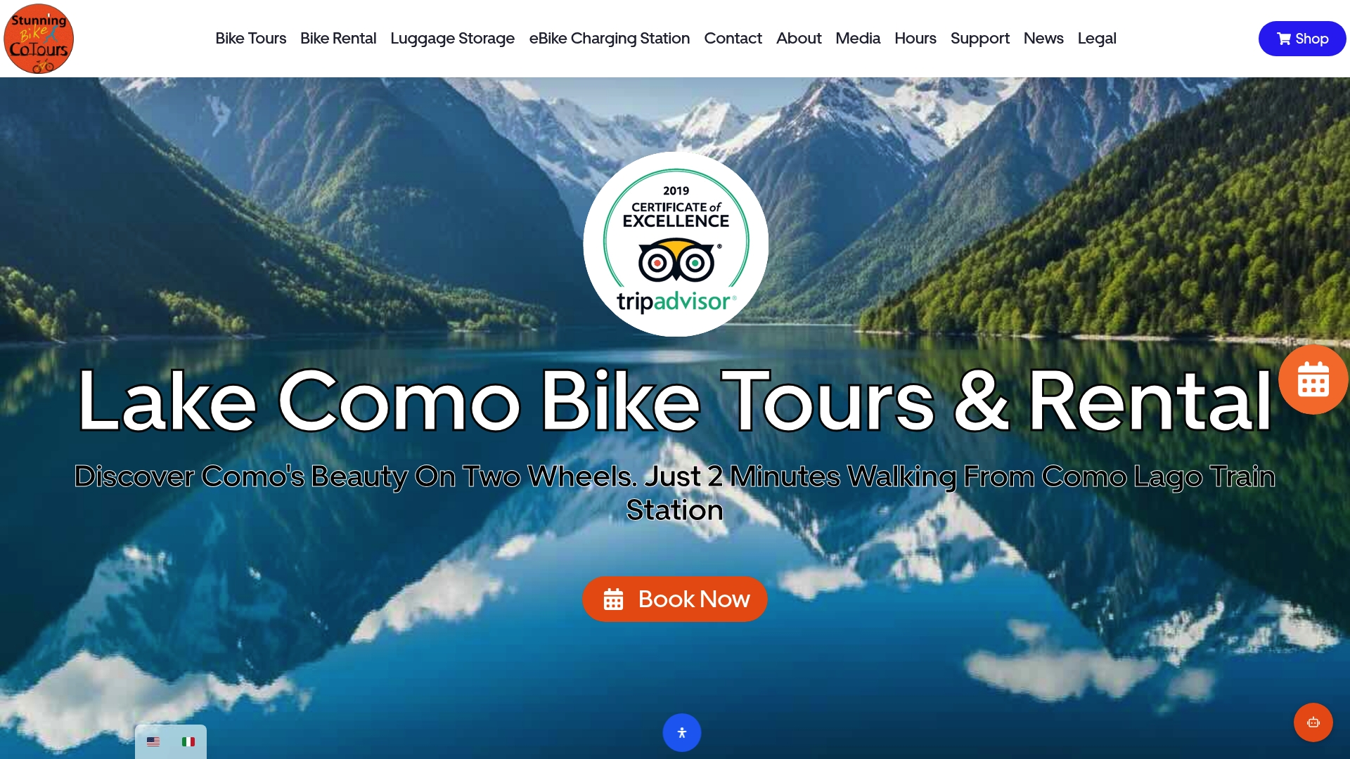
One quick note if you’re hunting for the shop in person: Stunning Bike Co-Tours is tucked inside a hall of shops, a little set back from the main street, but you’ll spot it by the large storefront window lit up with an LED bike display. Nearby you’ll also find Como Rental Solutions, which mainly rents motorbikes rather than bicycles. The two are easy to mix up given the proximity, so look for the LED bike in the window to know you’ve found the right shop.
If you’re weighing a guided tour against a solo, app-planned ride, browse rentals and tour options to see current availability and book directly for the dates you need.
Strava’s free tier covers ride recording, basic stats, and segment participation, making it the most widely used free option, though MyWhoosh offers a fully free immersive indoor riding experience if training indoors is your priority.
This isn’t a standard, documented training principle covered by the research behind this article, and definitions vary depending on the source, so it’s worth treating any specific claim about it with caution rather than a fixed rule.
ROUVY and FulGaz both use real-world video footage of outdoor roads, including actual gradient changes, which most riders find noticeably more realistic than the animated worlds used by platforms like Zwift.
Strava is the strongest choice specifically for tracking rides and staying motivated through social features and segments, but riders who need turn-by-turn navigation or structured training plans typically pair it with Komoot or TrainingPeaks rather than relying on Strava alone.
Yes for most casual and moderate-distance riding, though a dedicated head unit still wins for battery life and data accuracy on rides longer than a couple of hours.